Offline GPS navigation with topographic maps and aerial imagery for Germany
Note: This app is not affiliated with or endorsed by any government entity. It displays publicly available open geodata from the government agencies listed under "Data sources" below.
Easy-to-use outdoor navigation with high-resolution topographic maps, aerial imagery from German surveying agencies, and advanced navigation tools – ideal for hiking, cycling, and all outdoor activities.
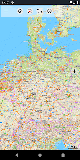
High-Resolution Maps for Germany
- Basemap LiDAR Hillshade: based on ATKIS Base-DLM data (BKG) with fine hillshading
- DTK Topo LiDAR Hillshade: topographic maps (DTK series) with detailed shading
- TopPlus (BKG): alternative cartographic style, also covers Europe at reduced resolution
- Aerial imagery with up to 20 cm resolution
Spot even small terrain features such as historic paths, foundations, or former borders.
Maps of the Federal States
- Aerial imagery (10–40 cm resolution)
- Topographic maps DTK10, DTK25, DTK50, DTK100
- Terrain models (DGM) and surface models (DOM)
- Cadastral (parcel) maps
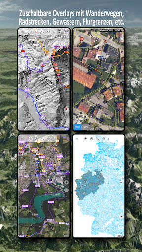
- Overlays such as water networks and hiking trails
Worldwide Maps and Layers
- AtloMaps Hillshading v4: terrain model with 1 m resolution
- AtloMaps OSM: OpenStreetMap-based topo map with hillshading, worldwide
- CyclOSM cycling map
- ESRI Topographic, Aerial, and Street
- Bing Maps and Satellite (online only)
- Overlays: hiking/cycling routes, hillshade, water features
More than 60 map types for Germany plus global maps.
Compare and Combine Maps
- Combine maps as overlays
- Compare with a transparency slider
- Pick the best map for each region and use case
Offline Maps and GPS Navigation
- Download maps, use fully offline, no roaming costs
- Record GPS tracks (distance, speed, elevation, accuracy)
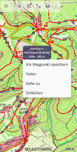
- Waypoints and direct navigation to waypoints
- Measure distances and areas
- Tap the map for elevation and distance
- Track replay, customizable data fields
- Place and address search
- Coordinates: WGS84, UTM, MGRS
- Import/export GPX, KML, KMZ and share via email or messaging apps
Pro Features
- Easy download of large map areas
- Create and edit routes, route navigation incl. automatic routing
- Unlimited waypoints and tracks
- Custom map sources (WMS, tile servers, MBTiles)
- Ad-free
Ideal for hiking, cycling, mountain biking, camping, geocaching, skiing, climbing, off-road, hunting, aviation, and search & rescue.
Data Sources – Government Geodata
- Germany-wide: Bundesamt für Kartographie und Geodäsie (BKG) – https://www.bkg.bund.de
- Baden-Württemberg: LGL – https://www.lgl-bw.de
- Bayern: LDBV – https://www.ldbv.bayern.de
- Berlin: Geoportal Berlin – https://gdi.berlin.de
- Brandenburg: LGB – https://geobasis-bb.de
- Bremen: GeoInformation Bremen – https://www.geo.bremen.de
- Hamburg: LGV – https://www.geoinfo.hamburg.de
- Hessen: HVBG – https://hvbg.hessen.de
- Mecklenburg-Vorpommern: LAiV – https://www.laiv-mv.de
- Niedersachsen: LGLN – https://www.lgln.niedersachsen.de
- Nordrhein-Westfalen: Geobasis NRW – https://www.geobasis.nrw.de
- Rheinland-Pfalz: LVermGeo – https://lvermgeo.rlp.de
- Saarland: LVGL – https://www.lvgl.saarland.de
- Sachsen: GeoSN – https://www.geodaten.sachsen.de
- Sachsen-Anhalt: LVermGeo – https://www.lvermgeo.sachsen-anhalt.de
- Schleswig-Holstein: LVermGeo SH – https://www.schleswig-holstein.de/lvermgeosh
- Thüringen: TLBG – https://tlbg.thueringen.de
Used under the respective open data licenses (e.g. dl-de/by-2-0).
Other sources: OpenStreetMap contributors, Esri, Microsoft Bing Maps.
Privacy: No tracking. No data collection. Your location data stays on your device.
Support: support@atlogis.com